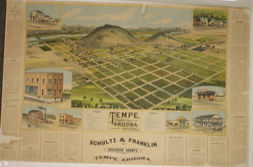
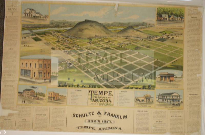
Illustrated Map of Early Tempe
Maker
C. J. Dyer
Date1888
MediumBlack Print on Paper
DimensionsOverall: 40 x 32 in. (101.6 x 81.3 cm); Large
ClassificationsDocumentary Artifact
Catalog number1995.1.221
DescriptionSchultz and Franklin, exclusive agents for the City of Tempe, promote growth with photos and information.Status
Not on view


Louis C. Hughes, Governor of the Territory of Arizona
11/13/1894
Genuine Curteich Chicago "C. T. American Art"
1930-1944