Museum Home
Collection Information
Contact Us
Skip to main content
Collections
Categories
People
Exhibitions
Thesaurus
Favorites
About
Advanced Search
Image Not Available
for Municipal Utility Maps, Tempe
Share
Expand
Favorite
View PDF
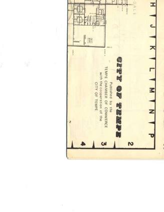
Municipal Utility Maps, Tempe
Previous
Next
Image Not Available
for Municipal Utility Maps, Tempe
Municipal Utility Maps, Tempe
Date
1985
Medium
Paper
Dimensions
24 × 36 in. (61 × 91.4 cm)
Classifications
Documentary Artifact
Terms
Map
City
Catalog number
1995.1.211
Description
Municipal Utility Maps of the city of Tempe.
Status
Not on view
Discover More
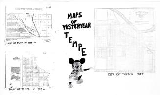
Maps - Three Maps of Yesteryear - Tempe 1885, 1893, 1939
Unknown
1939
Image Not Available
for Map of New Tempe Municipal Golf Course
Map of New Tempe Municipal Golf Course
c. 1972
Image Not Available
for Undergrounding Utility Lines
Undergrounding Utility Lines
7/15/1988
Image Not Available
for Tempe Maps Index - Environmental / Hydrologic Maps
Tempe Maps Index - Environmental / Hydrologic Maps
City of Tempe
c.1993
City of Tempe Map and School District maps, 1974
Tempe Chamber of Commerce
1974
Image Not Available
for Two Decades of Development, Maps- Tempe Old Town & Rio Salado
Two Decades of Development, Maps- Tempe Old Town & Rio Salado
City of Tempe Community Development Department
c.1990
Image Not Available
for Tempe maps, directories and fact books
Tempe maps, directories and fact books
1980s
Virginia Thompson Behind Desk Studying Maps - (2 of 2)
1986
Virginia Thompson Behind Desk Studying Maps - (1 of 2)
1986
Image Not Available
for McClintock Map Makers Painting Maps
McClintock Map Makers Painting Maps
1988
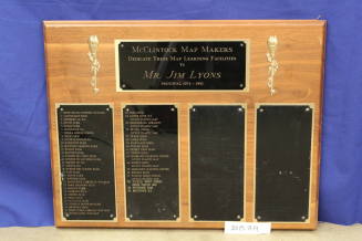
McClintock Map Makers Plaque of 50 Maps
1974
Image Not Available
for Proposed New Tempe Municipal Golf Course
Proposed New Tempe Municipal Golf Course
1972-1975