OS-39 Hudson Cotton Camp at Southern and Rural
Datec. 1919
MediumPaper
ClassificationsDocumentary Artifact
Catalog number1987.1.13
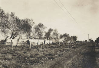
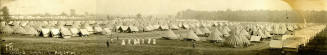
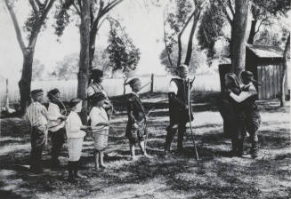
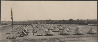
DescriptionHudson Cotton Camp at Southern avenue and Rural road. It was home to hundreds of farm laborers who picked cotton by hand in the area fields. The cotton pickers would move from farm to farm. A duplicate of this image is 1987.1.2941.The identification of this photo as the Hudson Cotton Camp at Southern and Rural around 1919, is reinforced by at least three historic sources. These sources are a county land purchase record from November 27, 1920, a 1923 County Landownership Map, and a 1930 aerial photo of the area. The 1930 aerial photo of an area east of the Southern and Rural intersection show what may be the exact location seen in the photo (the aerial photos are from the Flood Control District of Maricopa County). The possible location in the photo is on the north side of Southern Avenue, between Terrace Road and Dorsey Lane.
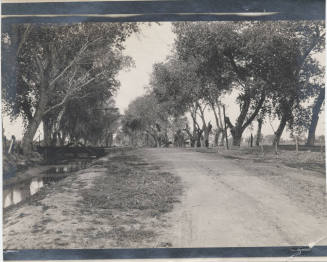
In November 1920, E. W. Hudson purchased from Mary E. Myers approximately 160 acres in the south half and the northeast quarter of Section 26, of Township 1 North, Range 4 East in present-day Tempe – this encompasses the area northeast of the intersection of Rural Road and Southern Avenue. This document specifies that the land purchased included a portion of the Tempe Canal known as the Petersen Ditch. This irrigation ditch cut across Hudson's property at an angle toward the southwest, before it turned west to follow Southern Avenue (between today's Terrace Road and Dorsey Lane). The Hudson Cotton Camp may be so named because it was on E. W. Hudson's property, or because he was leasing and growing cotton on the land prior to the time that he purchased it. This suggests that the photo could date anytime between 1919 and 1921 (to include the 1920 to 1921 cotton harvest season).
More than a dozen large tents are visible in the photo. Roughly half are straight-sided “wall” tents, and the rest are conical types known as “Sibley” tents from the name of the design's original soldier-inventor in the mid-1800s. In the background behind the tents and the line of cottonwood trees is what appears to be more cottonwood trees, and these likely follow the alignment of the Petersen Ditch toward the northeast portion of Hudson's property.
Status
Not on viewCollections
August 24, 1907

August 25,1907
ca 1908
circa 1925
circa 1927