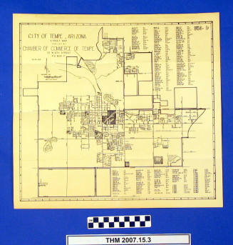
Tempe Street Map
Date1961
MediumPaper
Dimensions16 x 15 in. (40.6 x 38.1 cm.)
ClassificationsDocumentary Artifact
Catalog number1995.13.16
DescriptionStreet map produced by the Tempe Chamber of Commerce showing area between 48th Street and Price (west-east), and between the Salt River and Baseline Road (north-south), including an index of streets. Map has copyright of 1961; a date of 1962 is handwritten in pencil on the back.Status
Not on view